



A web atlas at alpineresilience.org gathers the data, models and field experience behind Europe's protective mountain forests – and invites anyone, from a researcher to a regional forester or even a curious hiker, to use it and contribute.
When you are on a road below a steep Alpine slope and you see the trees above you, these trees are not only a part of magestic scenery. They serve nature's resilience: a forest on a slope holds back snow before it becomes an avalanche, catches boulders before they reach the switchback, slows the water that would otherwise arrive in the valley all at once. Foresters call these protective forests, and across the Alps they stand between the region's residents and the mountain serving as a shield for roads, railways, villages, and towns.
Under changing climate conditions that shield is being tested. Windstorms are felling stands that stood for a century. Bark beetles are finishing what the wind starts. Fires are burning at elevations and in months where fire was once a marginal concern. And these hazards increasingly arrive together, or in sequence – what researchers call compound and cascading events. A slope stripped by fire is a future rockfall problem.
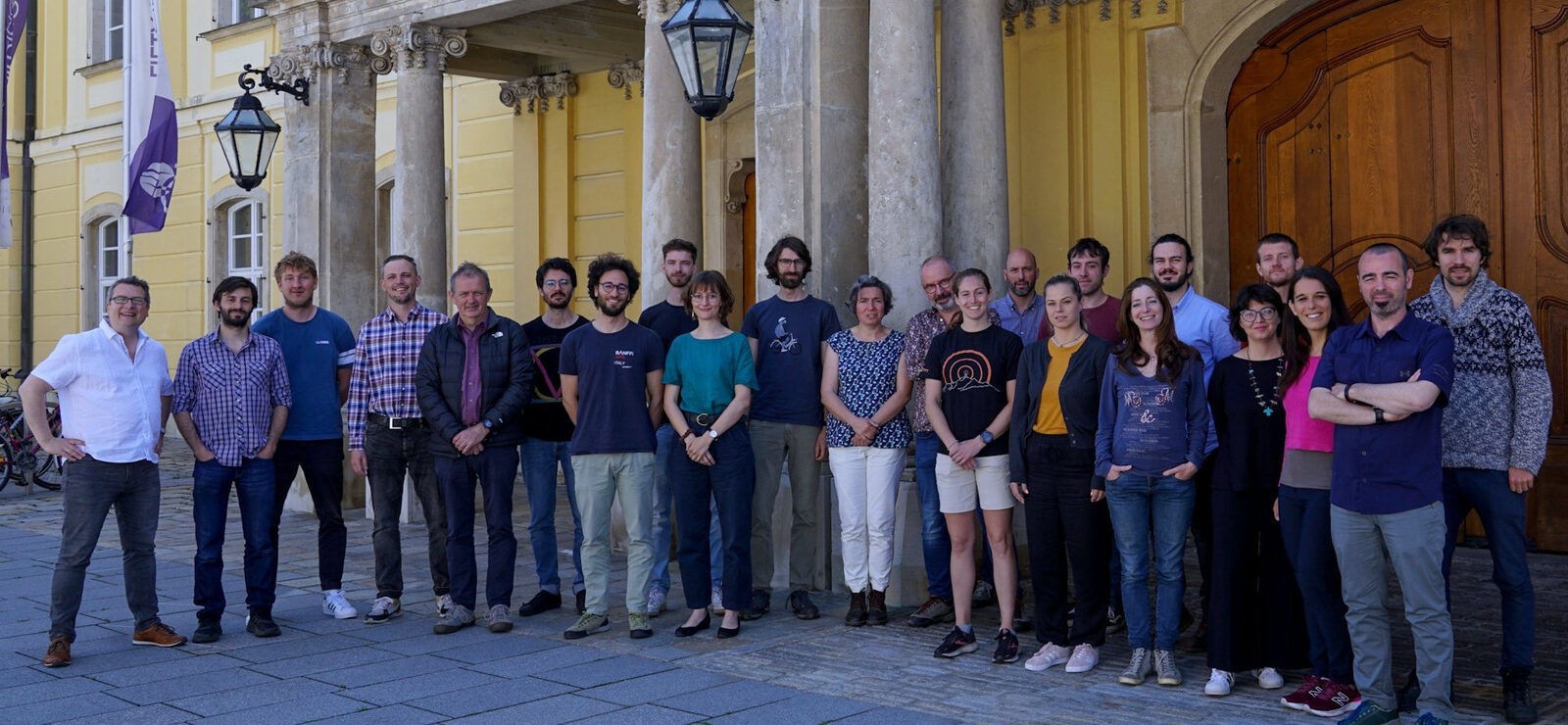
Today the EU-funded MOSAIC project publishes the Alpine Resilience Web Atlas, a free web platform that assembles the knowledge about forests from twelve European research institutions, including IIASA, from six countries – Austria, Switzerland, Slovenia, Italy, France, and Germany. The platform features maps, models, datasets, the field experiments, and the stories, told so that anyone can follow them.
 © IIASA
What the Atlas does
Every map in the Atlas is a real geographic information system in a browser window, not a picture of one. Users can switch basemaps, toggle layers, adjust layer opacity, click a feature to read its attributes, right-click to copy coordinates, upload their own shapefile as a zip to overlay on the analysis, and download the underlying layer as a shapefile to take into their own GIS.
Stories currently host 23 illustrated long-form articles about a real place and a real event, each with its own interactive map embedded in the text. Readers can filter stories by eight categories: Avalanche, Bark Beetle, Communication, Models, Rockfall, Tools, Wildfire and Windstorm. A “Surprise me” button picks one at random.
Forest Living Labs is an interactive map of field sites across Slovenia, Italy, Austria, Switzerland and France. Each site opens a card listing its main hazards, its actual management problem, a photograph, and a downloadable fact sheet. A Catalogue “Protective Forest Management in the Alps: An Illustrated Guide” draws together results from all of the project's components and from the network of the Forest Living Labs featuring the aggregated results for measures behind resilient Alpine protective forests. It is downloadable in English, French, German, Italian and Slovenian.
Hotspot Maps is a screening of Alpine tree species that demonstrates where vulnerable species and rising fire risk share the same ground. A collection of curated Datasets and Models is available, too. In addition, the web site features a term glossary, defining the vocabulary that usually divides the communities, so that the project speaks the common language.
Hotspot maps
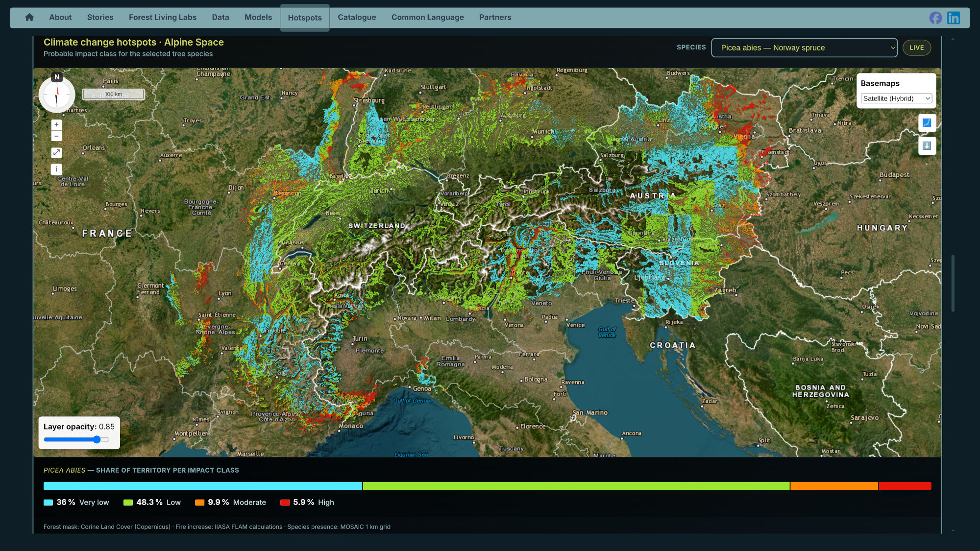
Maps that combine and mix several data sources help see where the fire risk meets the tree species and where the compound vulnerability really is. The Hotspot maps prepared by INRAE , ONF, and IIASA, which provided cross FLAM fire projections under climate change with a 1 km grid of presence probability for all 28 species, clipped to Copernicus forest cover so that every hotspot is a real stand. A slope where fire risk climbs steeply is no priority if the trees on it can cope, and a milder rise matters if they cannot.
 © alpineresilience.org
Open source – end to end
The Atlas runs on open-source software. The interface is built with Vue; the maps with OpenLayers; the spatial data is served by GeoServer over open standards, which means any GIS client can consume the Atlas's layers directly, without going through the website at all. The application is containerized and orchestrated with Docker and Kubernetes, and served behind nginx. There is no proprietary platform in the stack, no per-seat license, no vendor whose pricing decisions can one day put this research behind a paywall.
Anyone can contribute
Contributions are accepted from anyone. Data, models, stories, and field experience are welcome. Some examples of what the project is looking for is regional windthrow inventory nobody has published, a rockfall event database sitting in a municipal office, or a model someone wrote for one valley that would work in other valleys. The Atlas was built to hold exactly this kind of thing. Fill a story submission or data upload form or reach out to Pavel Kiparisov.
MOSAIC (Managing prOtective foreSt fAcIng clImate Change compound events) focuses on hazard-resilient and sustainable protective forest management in the face of climate change. The project collects, harmonizes and shares up-to-date data, models and trends on Alpine spaces, their climate and associated hazards, in support of regional and Alpine climate action plans, and works to raise awareness among foresters, risk managers, decision-makers and the public through an Alpine network of Forest Living Labs. MOSAIC is co-funded by the European Union through the Interreg Alpine Space programme (2021-2027).
News
15 October 2026
MowingQuest system-test campaign 2026 concludes, data collection continues
IIASA’s MowingQuest citizen-science campaign has wrapped up its August–September 2026 system test, with 25 pioneer users submitting almost 800 observations across eight countries. The results will help improve the app and data-quality workflows ahead of the main 2027 campaign. Two participants have also won Garmin GPS watches in the campaign raffle.

07 October 2026
MOSAIC results highlighted during Austria’s Protective Forest Week 2026
MOSAIC project results and IIASA research on climate-resilient protective forests are featured during Austria’s Protective Forest Week 2026, including work on wildfire risk, decision-support tools, and the Alpine Resilience Web Atlas.
06 October 2026
IIASA celebrates long-term partnership with MSc European Forestry Program
Coordinators, partners and graduates of the MSc European Forestry program visited IIASA on 29 September 2026. Twenty visitors from at least eight countries came as part of the alumni event held alongside the program's graduation ceremony at BOKU University in Vienna.