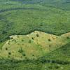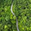
RESTORE+ aims at enhancing land use planning capacity related to restoration in Indonesia and Brazil. The project addresses restoration potential with a comprehensive assessment of degradation and restoration, combining the identification of degraded areas, multi-objective modelling and trade-off analysis.
Restoration of degraded land, as recently underlined by the declaration of the UN Decade on Ecosystem Restoration, is a significant contributor to the global effort of enhancing land use sustainability and addressing multiple related challenges such as the climate crisis.
Moreover, both focus regions of the RESTORE+ project, Indonesia and Brazil, have ambitious restoration related policies in place, such as Indonesia’s Climate Resilience Strategy and Brazil's commitment to the UNFCCC to restore 12 Mha of deforested areas by 2030.
These targets are challenged with the current situation in both countries. Indonesia lacks the necessary tools and high-quality data to identify degraded and marginal lands based on agreed definitions. In Brazil, detailed assessment of the forest restoration needs on previously illegally deforested area in the Amazon has not yet been possible due to the lack of registration of rural properties. Moreover, interventions and approaches differ widely, due to the diverging perceptions of degradation as motivation for restoration. Additional complexity arises through the need of landscape restoration to address contextual specificities and a range of interlinked practical challenges. This leads to the question as to how diverse and site-specific restoration activities contribute to the aspirational targets of national and global restoration efforts.
Striving to reconcile regional (landscape) heterogeneity with efforts to inform large scale restoration policies, the project aims at enhancing land use planning capacity related to restoration or utilization of degraded areas in Indonesia and Brazil. To this end, the project integrates biophysical aspects of degradation with social, policy and conservation dimensions by including enhanced datasets gained from novel mapping approaches into biophysical modelling, economic land use modelling and biodiversity impact assessment. Further, the potential of scalable financing mechanisms for restoration are examined.
Partners:
- World Agroforestry Centre (ICRAF)
- National Institute For Space Research (INPE)
- The Institute for Applied Economic Research (IPEA)
- UNEP World Conservation Monitoring Centre (UNEP-WCMC)
- World Resources Institute (WRI) Indonesia
- WWF Indonesia
- Mercator Institute on Global Commons and Climate Change (MCC)
- Environmental Defence Fund (EDF)
- Grantham Research Institute on Climate Change and the Environment (LSE)
Related Publications (Selection)
Brock, R.C., Arnell, A., Simonson, W., Soterroni, A., Mosnier, A., Ramos, F., Ywata de Carvalho, A.X., Camara, G., Pirker, J., Obersteiner, M. , & Kapos, V. (2021). Implementing Brazil’s Forest Code: a vital contribution to securing forests and conserving biodiversity. Biodiversity and Conservation 30 (6) 1621-1635. 10.1007/s10531-021-02159-x.
Zilli, M., Scarabello, M., Soterroni, A., Valin, H. , Mosnier, A., Leclere, D., Havlik, P. , Kraxner, F., Lopes, M., & Ramos, F. (2020). The impact of climate change on Brazil's agriculture. Science of the Total Environment 740 e139384. 10.1016/j.scitotenv.2020.139384.
Pirker, J., Mosnier, A., Nana, T., Dees, M., Momo, A., Muys, B., & Kraxner, F. (2019). Determining a Carbon Reference Level for a High-Forest-Low-Deforestation Country. Forests 10 (12) e1095. 10.3390/f10121095.
Krasovskii, A. , Khabarov, N. , Pirker, J., Kraxner, F., Yowargana, P., Schepaschenko, D. , & Obersteiner, M. (2018). Modeling Burned Areas in Indonesia: The FLAM Approach. Forests 9 (7) e437. 10.3390/f9070437.
Hadi, , Krasovskii, A. , Maus, V. , Yowargana, P., Pietsch, S. , & Rautiainen, M. (2018). Monitoring Deforestation in Rainforests Using Satellite Data: A Pilot Study from Kalimantan, Indonesia. Forests 9 (7) e389. 10.3390/f9070389.
News

05 November 2024


