


Evolution of the Copernicus Land Service Portfolio Integrating Novel EO Data and Latest Machine Learning Algorithms to Continuously Monitor the Status, Dynamics and Biomass of the Land Surface (EvoLand)
The EvoLand project under Horizon Europe is advancing land monitoring by evolving the Copernicus Land Monitoring Service (CLMS) through high-resolution, near-real-time data on land cover and use changes. Using innovations in machine learning, data fusion, and biomass mapping, EvoLand aims to enhance CLMS’s portfolio, deepening insights into key areas such as agriculture, forestry, water, and urban development.
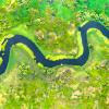
 © EvoLand
Main Objective of the project
EvoLand will develop and test new and innovative methods, algorithms, and candidate Copernicus Land Monitoring Service prototypes by integrating novel EO/in-situ data and latest Machine Learning techniques to continuously monitor the status, dynamics, and biomass of the land surface. Specifically, EvoLand will address eleven next-generation CLMS product candidates monitoring the status and changes of land use/land cover and various land surface characteristics at high resolution, through innovative data fusion approaches, continuous monitoring, AI and biomass mapping, and through integration of novel EO and in-situ data, as shown in the figure.
The Role of IIASA/NODES in EvoLand
NODES plays a pivotal role in EvoLand’s success. As leaders in the task of Novel In-Situ and Training Data, NODES is responsible for compiling existing in-situ datasets and filling gaps in land use data as well as improving automated techniques for training data generation—critical for developing next-generation machine learning models.
Existing in-situ datasets
By addressing some gaps in the existing datasets, NODES strengthens the foundation upon which the rest of EvoLand is built. For example, using data of drivers of biomass change, our work enhances our understanding of forest health and change dynamics—key for sectors like agriculture and forestry that are at the forefront of environmental policy discussions.
Furthermore, we will ensure that the data products emerging from EvoLand can be seamlessly integrated into policy frameworks, by creating a STAC catalogue with all in-situ datasets that can be made available to the public. This will empower decision-makers with timely and high-quality information, allowing for fact-based governance and a more sustainable future.
Automated techniques for training data generation
The next wave of Earth Observation depends heavily on artificial intelligence, especially machine learning (ML) and deep learning (DL) algorithms. To power these algorithms, NODES is developing new tools for the automated generation of training data. By leveraging homogenous objects from Sentinel-1 and Sentinel-2 satellites, we are pioneering labeling techniques that assign categories to these objects based on existing thematic maps.
This automatic labeling is essential for improving the speed and scalability of land monitoring. Traditional methods often relied solely on manual labeling, which can be time-consuming and error-prone. With our innovative approaches, complementing manual labeling with Artificial Intelligence, EvoLand is moving towards a future where training data can be generated on demand with greater accuracy and efficiency.
Generate a novel in-situ data set on land cover change
A key output from our work is the creation of pixel-based, high-resolution (10m) land cover change data. This dataset, spanning the years 2020-2022, will offer a detailed look at how landscapes have evolved across prototype sites. The novelty lies not only in the resolution but also in the methodology, which combines expert visual interpretation of very high-resolution (VHR) imagery with the latest geospatial tools. These datasets are crucial for calibrating and validating change detection algorithms that form the core of EvoLand’s CLMS prototypes. The resulting insights will not only help develop better land cover and biomass maps but also inform policymakers, stakeholders, and the Copernicus Entrusted Entities about future directions for Earth Observation services.
In conclusion, EvoLand is more than a technical project—it has clear implications for policy and decision-making. IIASA’s role in the EvoLand project is indispensable in realizing the vision of an evolved Copernicus Land Monitoring Service. By pushing the boundaries of data generation, quality control, and automated training data generation, we are helping to create the infrastructure that will guide Europe’s land management and environmental policy for years to come.
Involved colleagues from NODES include: Steffen Fritz, Myroslava Lesiv, Santosh Karanam, Monica Shishodia, Anto Subash, Maria Shchepashchenko, Orysia Yashchun, Zoriana Romanchuk, Katya Perez Guzman and others.
 © EvoLand
 © EU
© EU
The EvoLand project is funded by the European Union under grant agreement # 101082130.
News
17 December 2025
EvoLand’s new STAC Catalogue: Open data for exploring planetary change
If you’ve ever tried to piece together from academic publications how our planetary landscapes are shifting – from forests greening to croplands drying – you know it can feel like trying to assemble a puzzle when each piece comes from a different box. EvoLand’s new STAC Catalogue changes that. It aims to offer a simple, open doorway into the vast world of land-monitoring data, making it easier than ever to understand how our planet is evolving.