

Options Magazine, Summer 2022: Many coastal cities around the world are at risk of flooding due to rising sea levels. Few cities, however, face challenges like Jakarta. IIASA research shows that open data sources and tools can help cities prepare and identify vulnerabilities.
 © Pavel Kiparisov
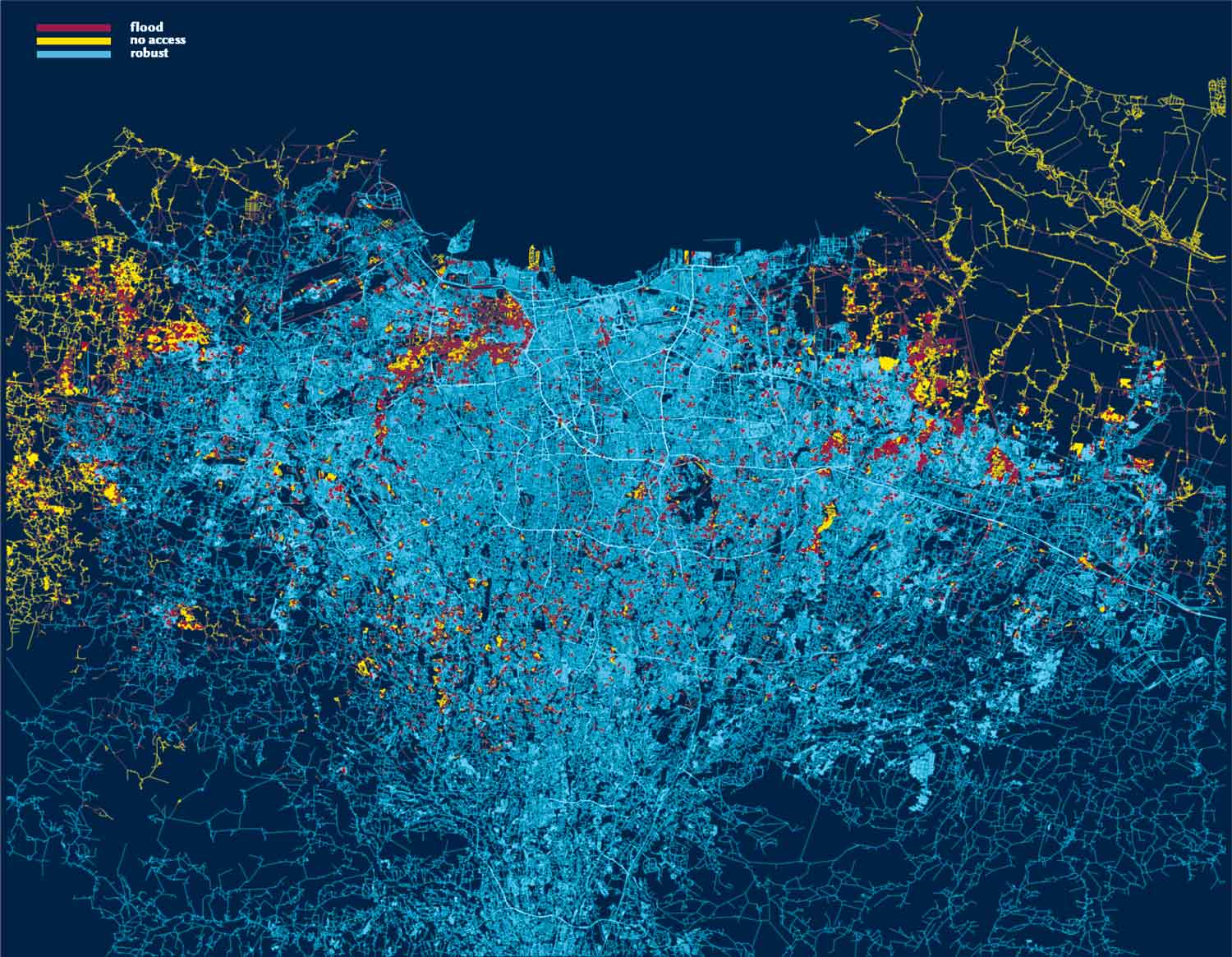
Situated on the Indonesian island of Java, Jakarta is home to 32 million people and is surrounded by several low-lying rivers that routinely swell during monsoon season. Increased pumping of groundwater in recent decades has also caused many parts of the city to sink.
In his report on his 2021 Young Scientists Summer Program (YSSP) project, Pavel Kiparisov, a PhD candidate in Environmental Sciences and Policy at the Central European University, shows that flood effects can be quantified relying solely on open data sources and tools.
Using this data, scientists can focus not only on predictions and their localization but also on identification of vulnerabilities of the whole system. This will help cities prepare for extraordinary events that are less predictable or not predictable at all. Additionally, Kiparisov explains, the suggested framework can be implemented by one researcher in a matter of minutes and hours, as opposed to post-disaster ground surveys, which are usually costly and time-consuming.
“With the growing frequency of disasters across the world and the threats they pose, we must have tools for identifying vulnerabilities in urban systems and rapid quantification of infrastructural damage and numbers of affected people,” explains Kiparisov. “My research marries network analysis with geographic information systems and proposes a framework that will become a basis of this kind of tool.”
By Jeremy Summers