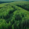
To combat forest loss in the tropics, a new study uses crowdsourcing to identify the drivers of deforestation. The resulting dataset can be used to create high-resolution maps and help policymakers apply the best protection measures.
Every year, 10 million hectares of forest disappear worldwide, predominantly driven by human activities such as agriculture expansion, building of roads, or wood extraction. To combat this trend and apply effective conservation measures, it is crucial to understand the drivers behind forest loss.
In a new study published in Nature Scientific Data, an international team of researchers harnessed the power of the crowd and set up a crowdsourcing campaign in December 2020 on the Geo-Wiki platform to compile data on the drivers of tropical forest loss between 2008 and 2019. In the analysis, the researchers asked participants to identify the predominant and secondary tree loss driver visible in a randomly shown location between 30° North and South of the equator and to note if roads, trails, or buildings were present.
The campaign was designed as a competition, with prizes offered to those who contributed the most, based on a combination of quality and quantity. 58 participants from various countries entered and together they reviewed almost 115,000 locations in the tropics, resulting in a dataset that has higher spatial resolution than any other such dataset to date.
“With the high resolution and dense spatial sample of this dataset we can create refined maps and get a better understanding of the drivers of forest loss during the past decade,” says IIASA researcher Juan Carlos Laso Bayas, the lead author of the study. “This is crucial to orient policymakers towards protecting remaining pristine forests, especially in the face of climate change and biodiversity loss.”
As well as being the first Geo-Wiki campaign focused on tropical deforestation, this campaign was also a step-up from previous efforts on Geo-Wiki, by providing participants with extensive training materials and tutorial videos, thereby ensuring high data quality. There was also an opportunity to talk “face to face” with IIASA experts via a chat service to solve any issues that would come up during the campaign.
The dataset is open-source and is available to use for researchers, policymakers, and the public. A recent study conducted by IIASA researchers has already made use of the data, analyzing deforestation in protected areas to gauge the effectiveness of the conservation measures and prompt management change where required.
“Getting involved with scientists through crowdsourcing campaigns such as this one is easy, rewarding, and can be of utmost importance to generate real change of policies by providing validated data on global events,” concludes IIASA researcher and study author Linda See.
Reference
Laso Bayas, J.C., See, L., Georgieva I., Schepashchenko, D., Danylo, O., Dürauer, M., Bartl, H., Hofhansl, F., et al. (2022). Drivers of tropical forest loss between 2008 and 2019. Scientific Data DOI: 10.1038/s41597-022-01227-3
News

22 July 2024
Are sustainable aviation fuels truly sustainable?

17 July 2024
Forests endure as carbon sink despite regional pressures

16 July 2024


