Comprehensive downloadable data and analysis on the Russian forestry sector
FAST FACTS
- The enormous scale of Russian forests generates large problems with respect to data, which RFFD is designed to address.
- Russia is one of the "wood baskets" of the world, with some 51.6% of Russian territory covered by forests.
- Russian forests stretch across 11 time zones from west to east and several thousand kilometers from north to south, from the sub-Arctic to the sub-tropics.
- The new databases and analysis respond to the imperative of developing policies to cope with, adapt to, and shape changes in the Russian forest sector in the future.
Background
IIASA’s Forestry Program began to develop a modeling framework for the pan-Russian analysis of forest productivity and growth. At the same time, huge databases were assembled in Russia based on growth information, including data collected from experimental plots, and other important forestry research aspects.
The first interim reports on this activity were presented in 1996, and the work has continued. New models have been developed for individual species, and additional data collected so that a reliable basis for analyzing the growth and productivity of the main Russian forest species at the pan-Russian level can be achieved. The significance of this work—a multi-person, multi-year effort on the part of the Forestry Program and its colleagues in Russia—has been heightened by the increasingly important context of global change.
The Russian Federal Forest Service has provided a careful professional analysis of the materials, such as the models and tables, which are presented in complete form, and has recommended their practical use within Russian forestry and forest management. The RFFD also includes some of the very diverse information available on forests and forest management in Russia.
The Russian Federal Forest Service are using the database as an input to both the development of sustainable forest management in Russia and to policy formulation.
It is also hoped that the RFFD will be useful to the international scientific community working in different aspects of research into Russian forestry and the forest sector.
Challenges
The Russian forest sector faces large and dramatic challenges. The transition to sustainable forest management (SFM), so urgently required, has not yet been implemented to the point where it can appreciably mitigate the threats facing Russian forests and the Russian forest sector.
To implement SFM, many economic, political, social, legislative, and institutional hurdles need to be overcome. Currently, Russian forest management practices do not take account of problems stemming from global change. The new databases and analysis respond to the imperative of developing policies to cope with, adapt to, and shape changes in the sector.
 © IIASA
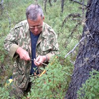
Man in forest
IIASA's Russian Forests & Forestry Database (RFFD) contains downloadable data and analysis on multiple aspects of the Russian forestry sector. The RFFD itself contains several huge individual databases, along with analyses of pan-Russian forest productivity and growth conducted by IIASA within a modeling framework developed since the mid-1990s.
How the RFFD works
All data presented on the Web page entitled Russian Forests and Forestry is available for download. It is grouped under page headings, for example, growing conditions, forest code, forest fund, growth/productivity, etc.
The databases are stored as either Microsoft Excel spreadsheets (.xls) or as PDF documents. The .xls files can be imported into various database packages as well as various GIS packages. The data contained in the PDF files can be copied and, with some effort, inserted into a database.
The majority of the spatial datasets are in vector format and stored as Arc/Info shape files. These are most easily imported into ESRI's Arc/Info GIS; however, most GIS packages also provide for the import of Arc/Info data. ESRI has produced a GIS package, Arc Explorer, that can be downloaded free from the ESRI website. This package provides basic GIS functionality allowing for database queries, mapping etc.

