
This project is funded by the Government of Norway’s International Climate and Forest Initiative (NORAD). It aims to build an independent alliance that can efficiently monitor forest governance in the DRC and to promote the conservation of natural forests to maintain their carbon storage capacity particularly in REDD+ areas.
Overview
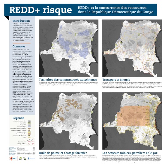
Growing resource demand worldwide threatens the future of tropical forests. In the DRC deforestation and degradation are driven by extraction of minerals, timber, oil palm and agricultural products for both domestic and international consumption, as well as population increases at the local level that increases the prevalence of slash and burn agriculture, artisanal logging, and charcoal collection. Current efforts to stem deforestation in the DRC remain limited, fragmented and under supported. This project brings together a diverse group of actors operating on different sectors and scales for addressing deforestation drivers and good forest governance to a common platform. This single mapping platform is known as Moabi. Moabi uses open source software. During the course of this project, Moabi is being designed, built, and maintained in collaboration with international and DRC-based developers in order to be sustainable beyond the life of the project. Moabi allows simple editing, validation and sharing of data between different government departments, civil society, and research institutions. It guides DRC government ministries to identify competing land uses within the REDD+ process such as mining permits, road projects, oil palm plantations and illegal logging. Moabi gives civil society the ability to file grievances anonymously, register their organizations, and file land claims. All of which contributes to a new paradigm of collaboration and transparency between the actors who will determine the fate of DRC’s rainforest.
IIASA Research
Development of an oil palm suitability map and the potential trade-offs between oil palm plantation expansion, forest conservation, and land use planning in DRC is being assessed using the GLObal BIOsphere Management model (GLOBIOM). Mapping platform driver data is combined with earth observation data, socio-economic modelling and REDD+ policy impact assessment to guide improved policy outcomes and scientific research. The analysis is carried out in cooperation with the on-going REDD-PAC project (www.redd-pac.org) supported by ICI – Germany’s International Climate Initiative.
Follow the link to view the full size map.
 © IIASA