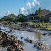
Losses from natural and man-made catastrophes are rapidly increasing. The main reason for this is the clustering of people and capital in hazard-prone areas, interdepedencis between economic activities, systemic risks, the creation of new hazard-prone areas. Warming climate is projected to be a driver affecting the frequency of extreme events, such as wildfires and flash floods, as well as the intensity of precipitation, wind speed, etc. The increasing vulnerability of the society calls for new integrated approaches to economic developments and risk management with an explicit emphasis on catastrophes and systemic risks. The integrated spatilly-explicit catastrophe risk modeling and management model (ISCRiMM) is beeing developed at CAT (Cooperation and Transformative Governance) group of the Advancing Systems Analysis (ASA) program at IIASA for spatial and temporal analysis and management of various natural disaster risks and possible chain risks in interdependet systems. This is a GIS-based model which explicitly accounts for the interplay between national and local ex-ante measures, e.g., investment in prevention/mitigation measures (on the part of the public authorities, the citizens and the insurance industry) and ex-post policies for sharing the financial costs after the disaster.

Purpose

The aim of the model is to conduct a conceptual and model-based analysis of structural and financial measures (strategic and operational, ex-ante and ex-post, long- and short-term) for mitigating and reducing the impacts of natural catastrophes, climate change and weather variability on national, subnational, and regional welfare, agricultural production, supporting objectives of sustainable land use planning and regional developments. Proper planning of local developments accounting for possible extreme events may substantially decrease regional vulnerability and catastrophic losses. Otherwise, the events can produce dramatic and long-term consequences for societies and economy.

The model is comprised of the four main GIS-based modules: hazard simulation (scenarios), vulnerability estimation, a multi-agent accounting system, and a decision-making stochastic optimization procedure. For example, the scheme of a catastrophe flood management model is presented in Figure below. The model addresses the specifics of catastrophic risks: highly mutually dependent and spatially distributed endogenous risks, the lack of historical location-specific observations (unknown risks), the need for long-term perspectives, robust strategies, and explicit treatment of spatial and temporal heterogeneities of involved agents such as farmers, producers, households, local and central governments, land use planners, water authorities, insurers, and investors.  

Methodology/How the model works/Data generation

A case study region is subdivided into grid cells or sub-regions with “homogenous” properties, i.e., the grid cells (not necessarily of strict geometrical form) may correspond to a collection of houses, a collection of land plots with similar land use practices (e.g., agricultural land), a segment of a pipe line, urban area, rural settlement. The choice of cells provides a desirable representation of potential catastrophic losses. The cells consist of the economic value of the physical (infra)structures. The hazard module is a Monte Carlo model, which simulates (or generates) scenarios of catastrophes as they may happen in reality. The vulnerability module estimates losses to property values according to vulnerability curves accounting for building codes, i.e., the capacity of infrastructures to withstand certain cat events The multi-agent accounting system derives histograms of gains and losses of the relevant agents (stakeholders) exposed to and involved in catastrophe management. The losses substantially depend on past and current developments planning decisions, risk attitudes and perceptions. To minimize the losses and achieve robust stable economic performance in the region, spatially explicit decision-making stochastic optimization procedure can track the gains and losses for each cat scenario and adjust the decision variables towards fulfillment of goals and constraints of the agents.

Integrated catastrophic flood management model © IIASA

Integrated catastrophic flood management model

Application

The model has been developed and applied in a number of catastrophic risks case studies, e.g., earthquakes, floods, livestock epidemics, windstorms, etc., jointly with colleagues from Italy, Ukraine,  Russia, US, Austria, Japan, Hungary, Sweden, Poland, China, the Netherlands, etc. The approach enables simultaneous analysis of complex interdependencies among damages at different locations to different agents and stakeholders, robust prevention, mitigation, and adaptation (both structural and financial) measures.

Supplemental Information 

Challenges: Novel stochastic optimization methodology, quantile-based safety constraints, induced discounting, and risk-adjusted downscaling procedures are used for the design of robust strategies coherent with goals and constraints of involved agents. Fast Monte Carlo stochastic optimization techniques are being developed and implemented in the model allowing to deal with significant computational complexities of the problems. Policy analysis is guided by GIS-based catastrophe models and stochastic optimization methods with respect to location-specific risk exposures. The model uses economically sound risk indicators leading to convex stochastic optimization problems strongly connected with non-convex insolvency constraint and Conditional Value-at-Risk (CVaR).

Fast facts: The model permits to analyze the implications of extreme events on the proper choice of discounting for evaluation of policies with long-term perspectives, e.g. climate change and catastrophe management projects such as construction and maintenance of dikes. The misperception of discounting may dramatically contribute to the alarming increase of regional vulnerability. The model has been used for designing optimal portfolios of financial instruments in catastrophe management, e.g. such as a composition of a multi-pillar flood loss-spreading program involving partial compensation to flood victims by the central government, a mandatory public-private insurance on the basis of location-specific exposures, a contingent ex-ante credit to reinsure the insurance liabilities, a catastrophe bond.