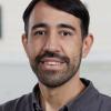
Juan Carlos Laso Bayas
Research Scholar
Novel Data Ecosystems for Sustainability Research Group
Advancing Systems Analysis Program
Contact
Biography
Juan Carlos Laso Bayas joined IIASA in September 2015 as a research scholar. He currently works with the Novel Data Ecosystems for Sustainability (NODES) Research Group of the IIASA Advancing Systems Analysis (ASA) Program. His scientific interests include the use of geographic information systems (GIS) and spatial statistics, more specifically mixed models, to analyze remote sensing and citizen science data, aiming to contribute to agricultural production, food security, disaster management, and community resilience. He has led several projects funded by the European Union, the European Space Agency, the Austrian Research Promotion Agency, and others.He obtained his BSc in Agricultural Sciences at Zamorano University, Honduras, specializing in Socioeconomic Development and Environment. He continued his studies in Germany where he obtained his MSc in Agricultural Sciences in the Tropics and Subtropics as well as his PhD in Agricultural Sciences at the University of Hohenheim, Stuttgart. For his dissertation, he studied the mega-tsunami event of December 2004 and combined remote sensing, GIS, and generalized linear mixed models to relate land use, distance to the sea, and topography to tsunami casualties and damage in West-Aceh, Indonesia, and the Seychelles.
His previous work experience includes: Advanced tropical agriculture and forestry field work at Zamorano; field technician at a joint USAID-Zamorano rehabilitation project after hurricane Mitch (1998) in south Honduras; student counselor at Zamorano; research assistant for the Illinois Natural History Survey at the University of Illinois Urbana-Champaign; technical assistant for the Illinois Crop Improvement Association, Champaign, USA; and researcher in cooperation with the World Agroforestry Centre (ICRAF-SEA), at Bogor, Indonesia.
Before joining IIASA, he worked as a statistical consultant for the Biostatistics Institute, at the University of Hohenheim, Stuttgart.
Last update: 23 MAR 2023
Publications
Laso Bayas, J.C. , See, L. , Perger, C., Justice, C., Nakalembe, C., Dempewolf, J., & Fritz, S. (2017). Validation of Automatically Generated Global and Regional Cropland Data Sets: The Case of Tanzania. Remote Sensing 9 (8) e815. 10.3390/rs9080815.
See, L. , Laso Bayas, J.C. , Schepaschenko, D. , Perger, C., Dresel, C., Maus, V. , Salk, C., Weichselgartner, J., Lesiv, M. , McCallum, I. , Moorthy, I., & Fritz, S. (2017). LACO-Wiki: A New Online Land Cover Validation Tool Demonstrated Using GlobeLand30 for Kenya. Remote Sensing 9 (7) e754. 10.3390/rs9070754.
See, L. , Perger, C., Dresel, C., Laso Bayas, J.C. , Fritz, S. , & Weichselbaum, J. (2017). LACO-WIKI: An online tool for land cover validation and area estimation. In: ISRSE37, 8-12 May 2017, Pretoria, South Africa.
See, L. , Dunwoody, A., Laso Bayas, J. C. , Moorthy, I., McCallum, I. , Fritz, S. , Jacques, D., & Waldner, F. (2016). Global Agricultural Monitoring Systems: Current Gaps and Possible Solutions. In: Global Land Project 3rd Open Science Meeting (GLPOSM16), 24-27 October 2016, China National Convention Center, Beijing, China.
McCallum, I. , Liu, W. , See, L. , Mechler, R. , Keating, A., Hochrainer-Stigler, S., Mochizuki, J. , Fritz, S. , Dugar, S., Arestegui, M., Szoenyi, M., Laso Bayas, J.C. , Burek, P. , French, A., & Moorthy, I. (2016). Technologies to Support Community Flood Disaster Risk Reduction. International Journal of Disaster Risk Science 7 (2) 198-204. 10.1007/s13753-016-0086-5.